Agvolution GmbH

Agvolution Farmalyzer

Recommendation fertilizer

Fertilizer cards - basic fertilization

Equation based analysis

Live biomass maps

Request product
Manufacturer website
Agvolution Logo
Agvolution Logo

Analyze all environmental factors and create economic application maps

The FARMALYZER is a decision support tool for agriculture, which collects and evaluates data from various environmental factors in crop production systems. Unlike conventional AI systems, FARMALYZER's decision support is built on the principles of "ecosystem models" that link crop response with environmental and farm management factors.

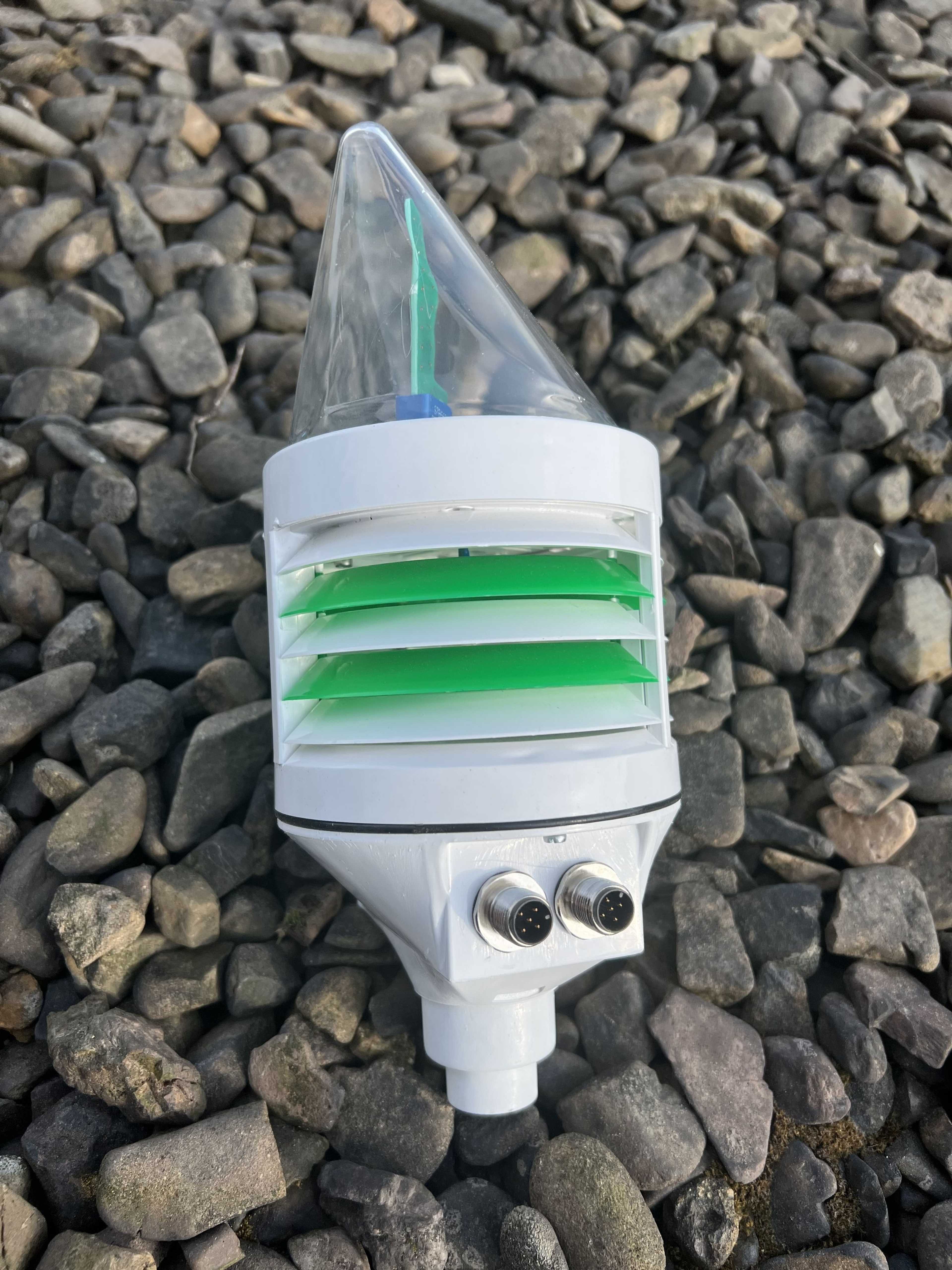
In addition to historical and current weather, ground and satellite data, operating data and economic key figures are also included in the calculations. In conjunction with the IoT weather sensors CLIMAVI mircorclimate and weatherstation, the local climate can be included. This results in economic decision-making aids for irrigation or nitrogen fertilization, which are output as diagrams or directly as application maps.

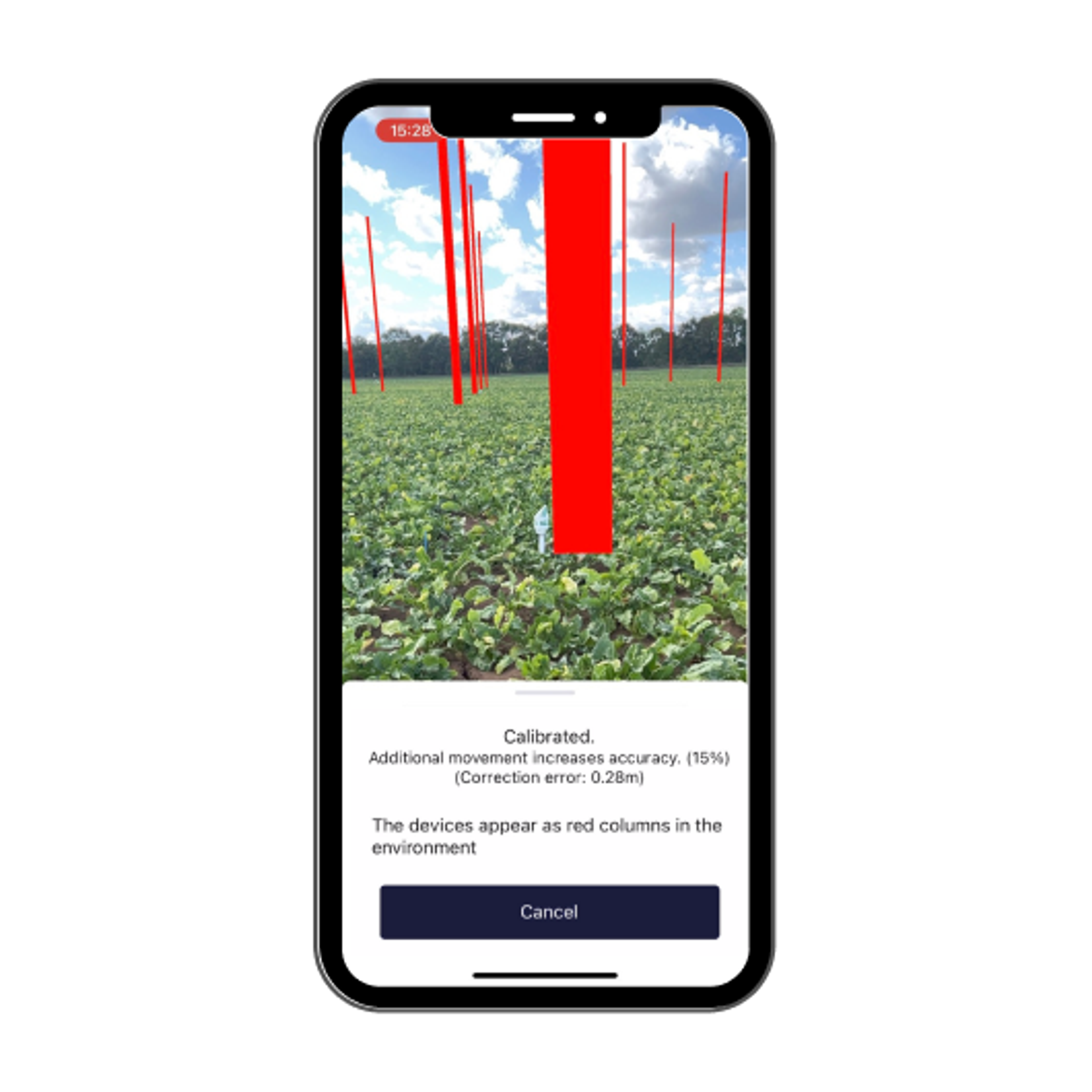
The smartphone positioning service (SPS) helps you to find your weather station.

Position is saved

  • Save position for many years
  • Exact 3D positioning
  • Interface & export of the geo data
  • Information is displayed

  • Navigate to position
  • Represent objects
  • Show information
  • Digital data acquisition and a link to the exact position

    Bonitures and notes

  • Capture digitally with your own forms
  • Link exact positions
  • Evaluate and export data
  • Cadastre and management

  • Manage items categorized
  • Link positions and information
  • Tag, describe and share via mail, chat or QR code
  • Pricing


    Upon request

    Free trial version


    Do you want a specific price? Get your individual offer now!

    Request

    Attributes


    This information has been reviewed and verified by the manufacturer. All data without guarantee.

    Compatibility

    John Deere Operations Center

    Support

    Phone support

    Mail support

    On-site support

    Remote maintenance

    Videotutorials

    Application videos and sample videos

    Software

    Browser application

    Android-App

    iOS-App

    Place of data storage

    Germany

    Seeding functions

    Sowing maps

    Harvest functions

    Maturity monitoring

    Cloud-free biomass and dry matter maps are available.

    Recommendation on harvest time

    By modeling the environmental factors, the influence on plant growth is determined. This makes it possible to forecast the time and quantity of harvest.

    Other subarea-specific functions

    Own accounting of different data bases

    Equation based analysis

    Consideration of distance requirements

    Soil Sampling Design

    Soil samples can be imported, documented and you can even build your own soil map based on your own knowledge and experience. These are then included in the modeling. Via the AR function, the sample location can be recorded with pinpoint accuracy and stored in a retrievable manner.

    Lane planning

    Economic zone evaluation

    For the first time, process-performance costing is possible, taking into account local conditions including weather influences. Imputed prices of inputs and revenue expectations can be taken into account in order to create an economic evaluation of plant cultivation measures. The KTBL data are stored as a basis, which can be individually adapted.

    Weather history

    Current weather data

    DWD (and other systems) weather data will be augmented with CLIMAVI measurements. This will allow an improvement of accuracy and the inclusion of microclimate It will also allow spatial weather and microclimate data grids.

    Weather forecast

    Watering functions

    Irrigation maps

    Water requirements and irrigation times can be determined on a site-specific basis. This enables irrigation to be carried out in line with requirements. A link with external irrigation starters is possible.

    Recommendation watering time

    Recommendation irrigation quantities

    Datenintegration

    As-Applied Daten

    Yield data

    Satellite images

    Ground sensors

    Soil analyses

    Soil samples can be imported, documented and you can even build your own soil map based on your own knowledge and experience. These are then included in the modeling. Via the AR function, the sample location can be recorded with pinpoint accuracy and stored in a retrievable manner.

    Topographic data

    Weather stations

    The connection of various weather stations and sensors is possible via the CLIMAVI.

    Type of data imports

    You have all the possibilities of data import

    Type of data exports

    You have all the possibilities of data export

    Plant protection functions

    Recommendation application quantity

    Field observation functions

    Live biomass maps

    Application videos and sample videos

    Field comparison

    Data layer comparison

    Georeferenced notes in the field

    Sharing of information possible

    Access to the sensor data is defined in the APP. This allows employees or consultants to access the selected data.

    Fertilizer functions

    Fertilizer cards - basic fertilization

    Recommendation fertilizer quantities

    Recommendation fertilizer

    Company


    Agvolution GmbH

    Germany

    Founding year:

    2020

    Similar products


    Available soon!

    We constantly add new features.

    Enable notications

    Categories


    Available soon!

    We constantly add new features.

    Enable notications