Bayer AG
Climate Field View
Weather history
Weather forecast
Irrigation maps
Yield data
Satellite images
Soil analyses


Simplify your field data management with ClimateFieldView.
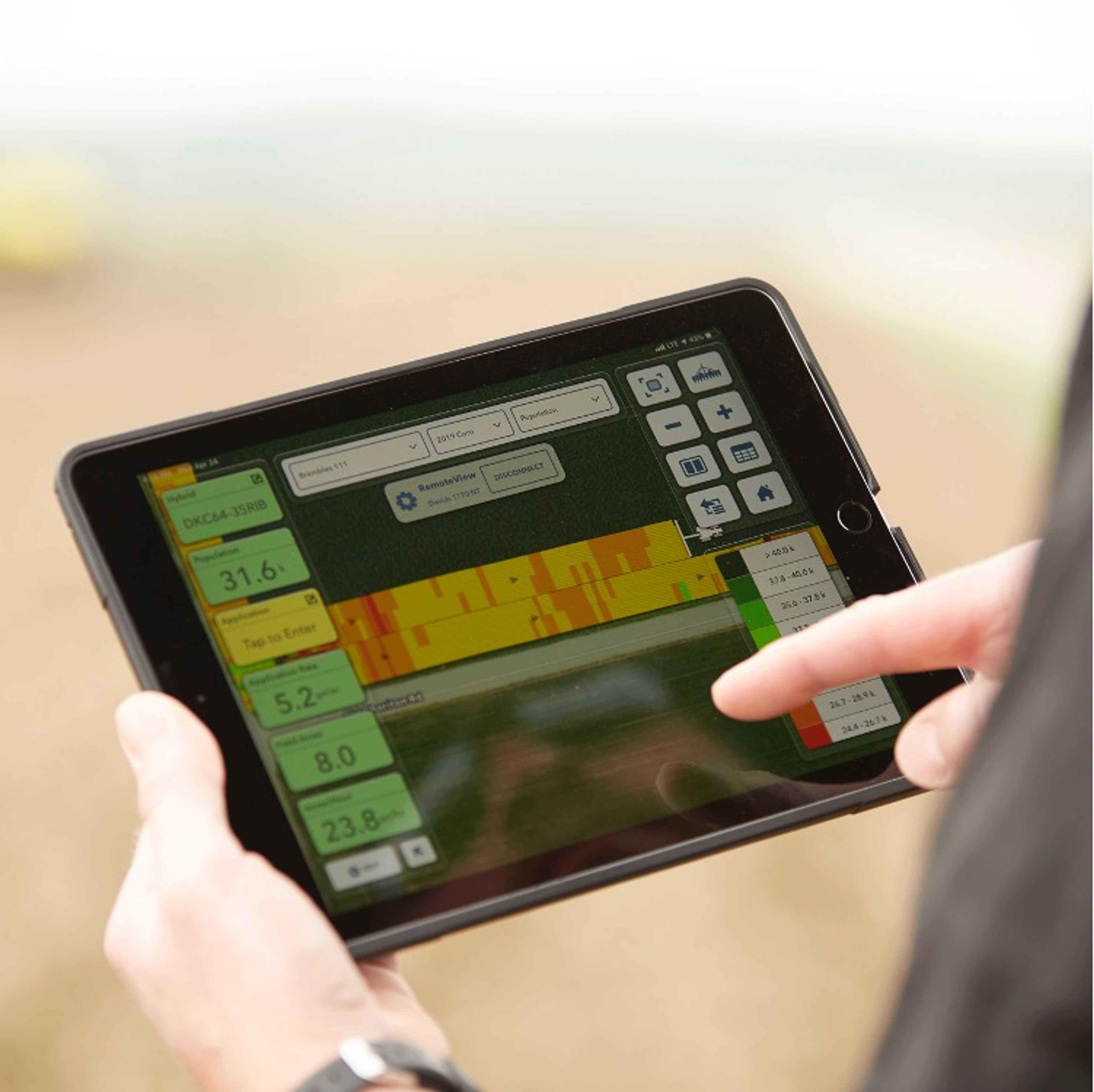
You know your fields - Climate FieldView™ is your data partner to help you with your daily decisions. Simplify your field data management! With the help of digital maps, you can better assess your sowing success. Get alerts on your mobile device about changing conditions in your fields so you can plan your day effectively.
Vegetation maps provide an overview of plant growth.
State-of-the-art, colored vegetation maps provide you with an overview of plant growth throughout the farm and help you to decide which fields need to be monitored as a priority.
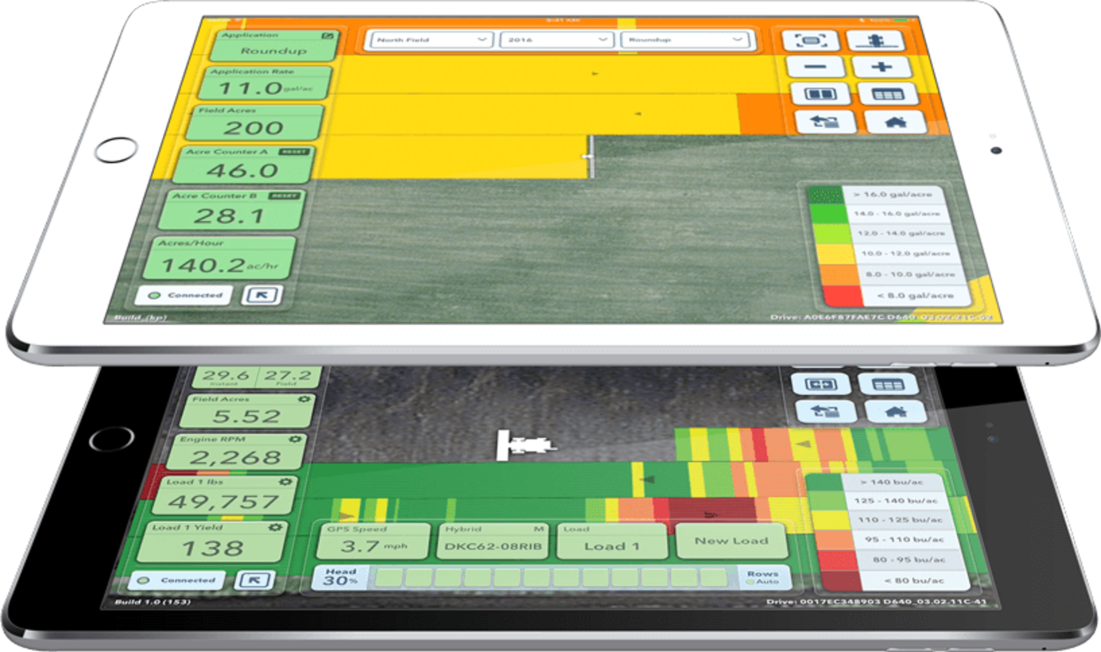

Analyze yield performance by variety, soil type or field.
Analyze your yield performance by variety, soil type or field so that you can make the best decisions for the coming season. You can export and print the corresponding reports or send them to your advisors.
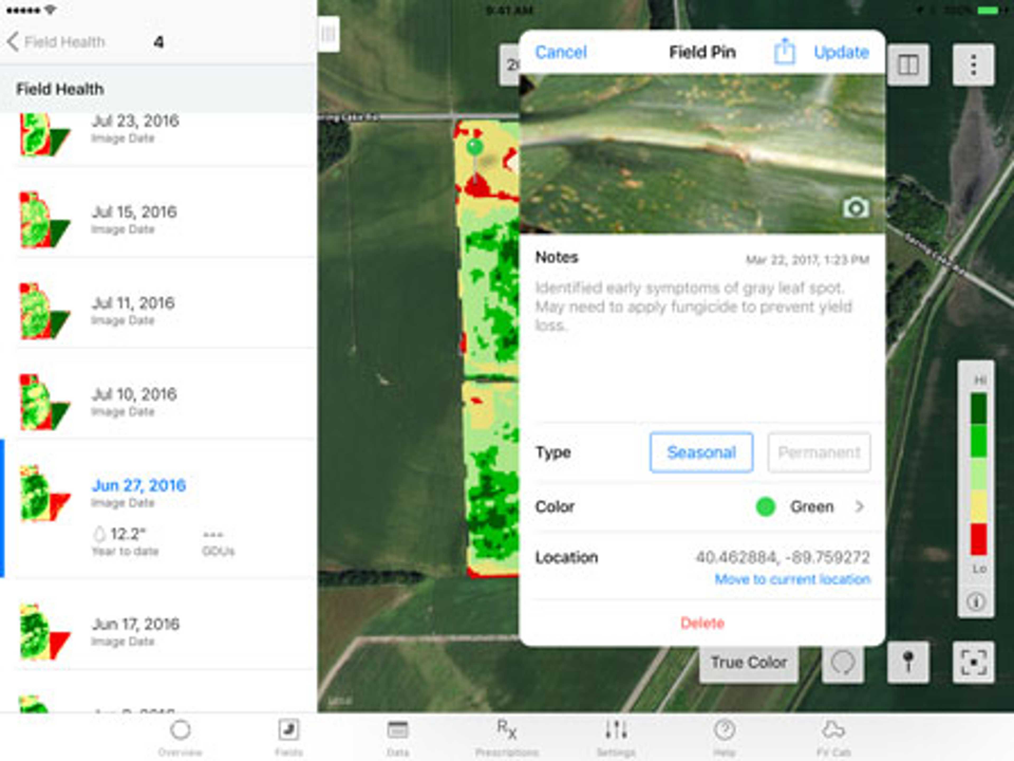
Evaluate arable farming practices on the basis of subplots.
Find out how different arable farming practices affect yields. To do this, a sub-area is viewed in isolation on your field map and a yield report is created for it.


Pricing
Ab
120 €
per year
Gradation by version (Prime 120€, Plus from 300€)
Optional: Drive hardware for 280€
Attributes
Compatibility
John Deere Operations Center
Other
Support
Phone support
Mail support
On-site support
Videotutorials
Software
Browser application
Android-App
iOS-App
Seeding functions
Sowing maps
Other subarea-specific functions
Own accounting of different data bases
Weather history
Current weather data
Weather forecast
Watering functions
Irrigation maps
Datenintegration
As-Applied Daten
Yield data
Satellite images
Soil analyses
Type of data imports
Plant protection functions
Application maps for fungicides
Growth regulator maps
Application maps for herbicides
Application maps for insecticides
Field observation functions
Live biomass maps
Field comparison
Data layer comparison
Georeferenced notes in the field
Sharing of information possible
Fertilizer functions
Fertilizer cards - basic fertilization
Fertilization maps - N fertilization
Company
Bayer AG
Germany
Founding year:
1863