geo-Konzept GmbH
FARMInfo
Access management
Manage Multiple Farms
Weather data
Weather station support
Application maps
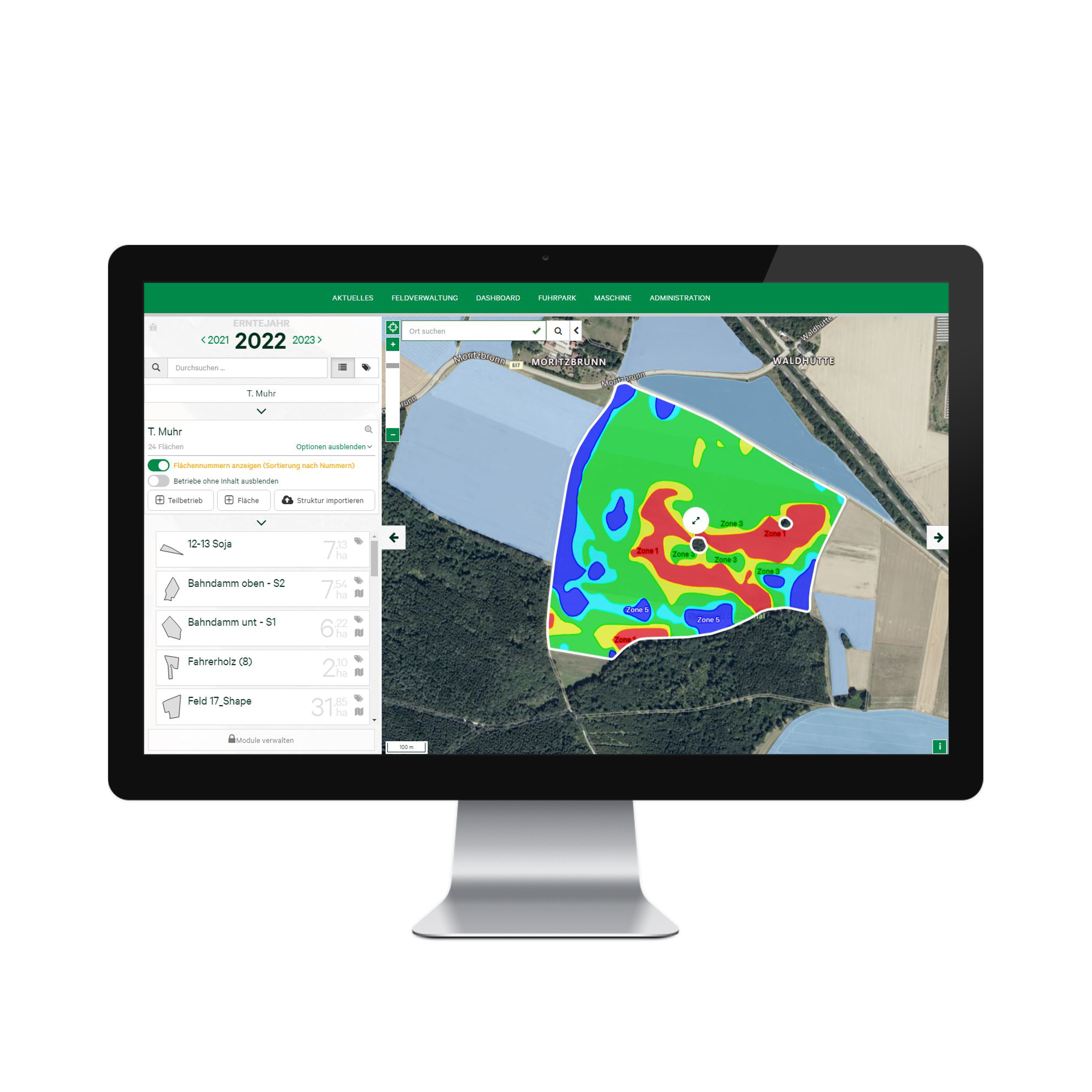
Biomass maps


Get to know the new way of data management with FARMInfo.
FARMInfo is a new way of managing data, where all crop-related areas of the farm can be linked together along with the existing data master (such as nutrient, yield and multispectral data). FARMInfo is modular and can therefore provide the decision support that is really needed. Whether it is the evaluation and interpretation of weather or yield data, application maps or other operational information: FARMInfo provides the answer - quickly and conveniently!
Pricing
Upon request
Free trial version
Modular expandable
Attributes
Support
Phone support
Mail support
On-site support
Remote maintenance
Software
Browser application
Place of data storage
Scope of functions
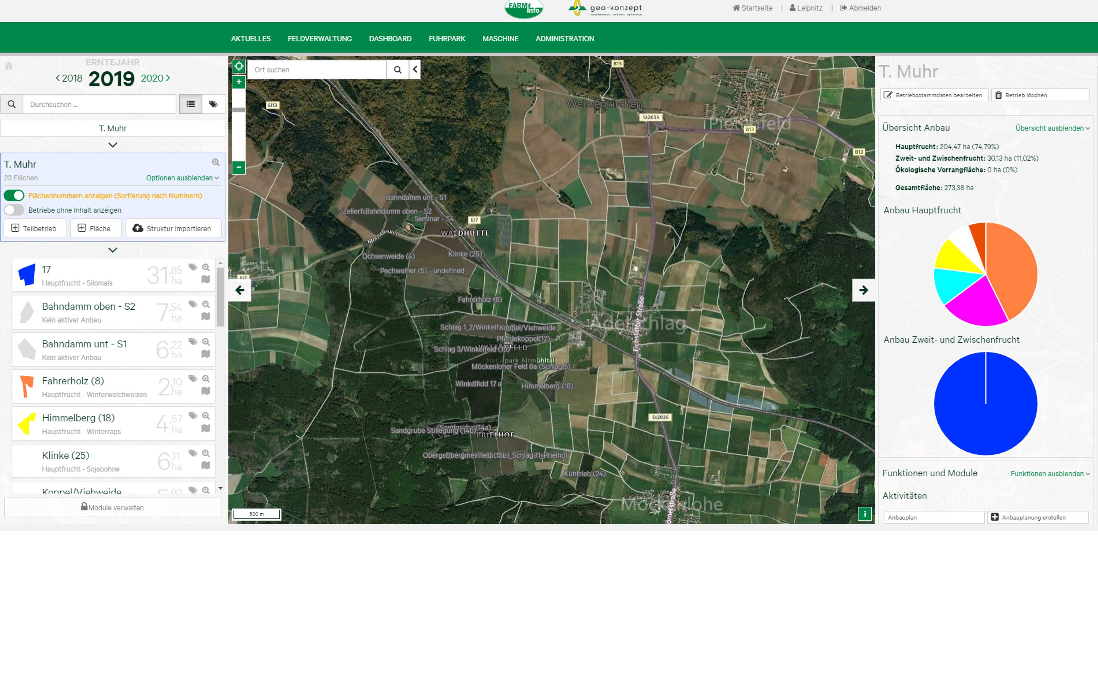
Field Registry
Sowing
Work planning
Operating resources
Cultivation plan
Measures
Notes
Compatibility
ISOBUS
Area management
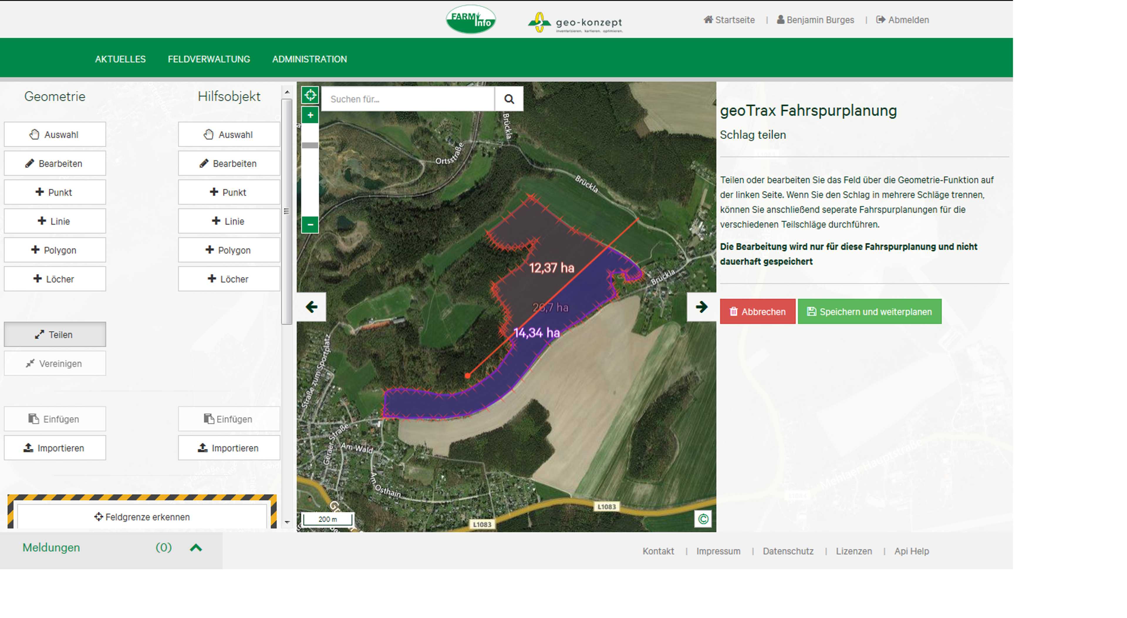
Field construction
Lease management
Subarea management
Fertilization function
Application maps
Biomass maps
Soil samples
Fertilizer function
Fertilization planning
List of fertilizers available on the market
Application maps functions
Application maps for fertilizers
- Can be combined with existing operating data
- Ideal planning basis for e.g. fertilization, sowing and plant protection
- Basis for site-specific application maps
- Optimized use of plant sensors
Application maps for plant protection
Seed application maps
Recommendation algorithm
Input format
Output format
Cloud independent satellite maps
User management
Employee Management
Access management
Manage Multiple Farms
weather
Weather data
Weather station support
Fleet Management
Machine orders
Documentation of machine times
Machine communication
ISOBUS communication
Company
geo-Konzept GmbH
Germany
Founding year:
1992