Flypard Analytics GmbH

Geopard

Yield data

Ground sensors

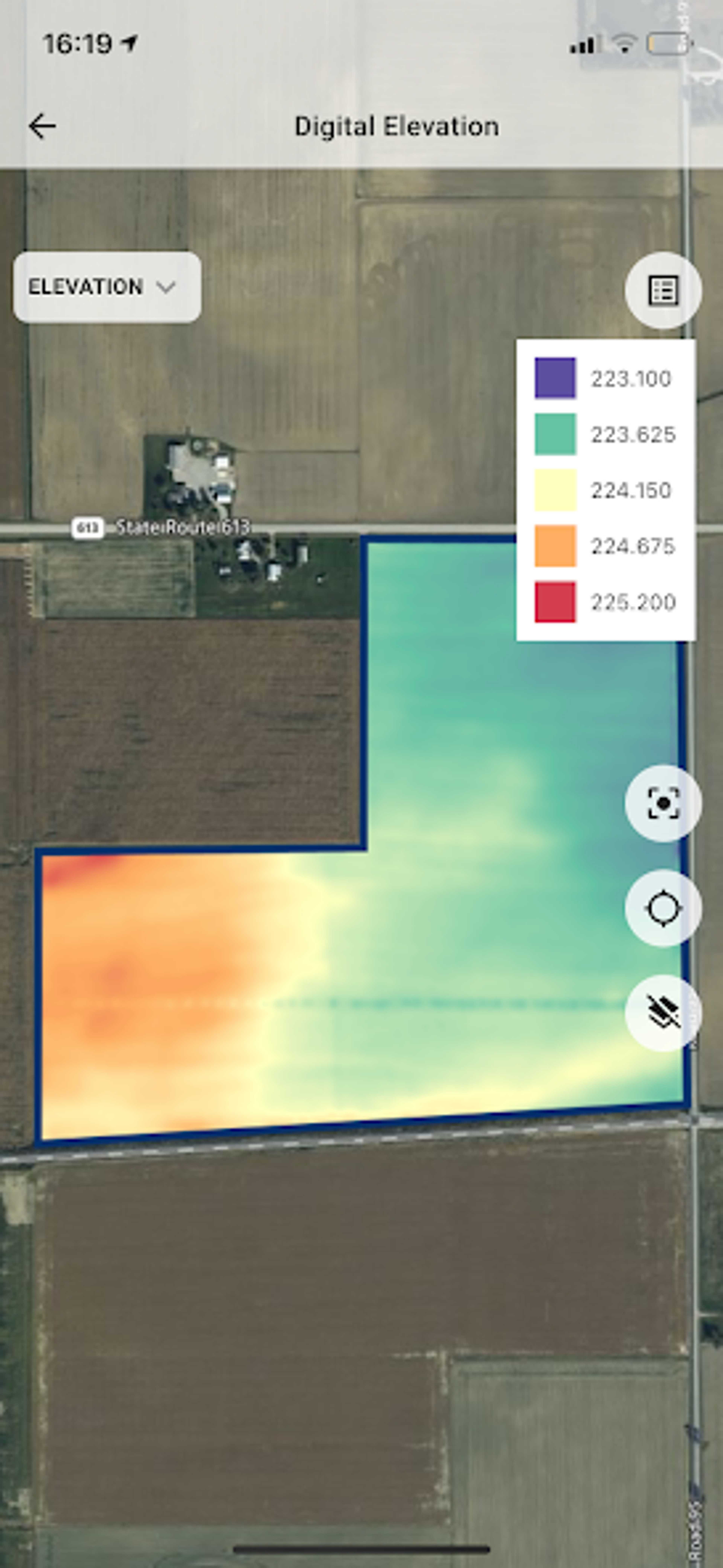
Topographic data

Application maps for herbicides

Field comparison

Request product
Manufacturer website

An intelligent platform that helps with precision farming practices that can increase the return on farm operations.

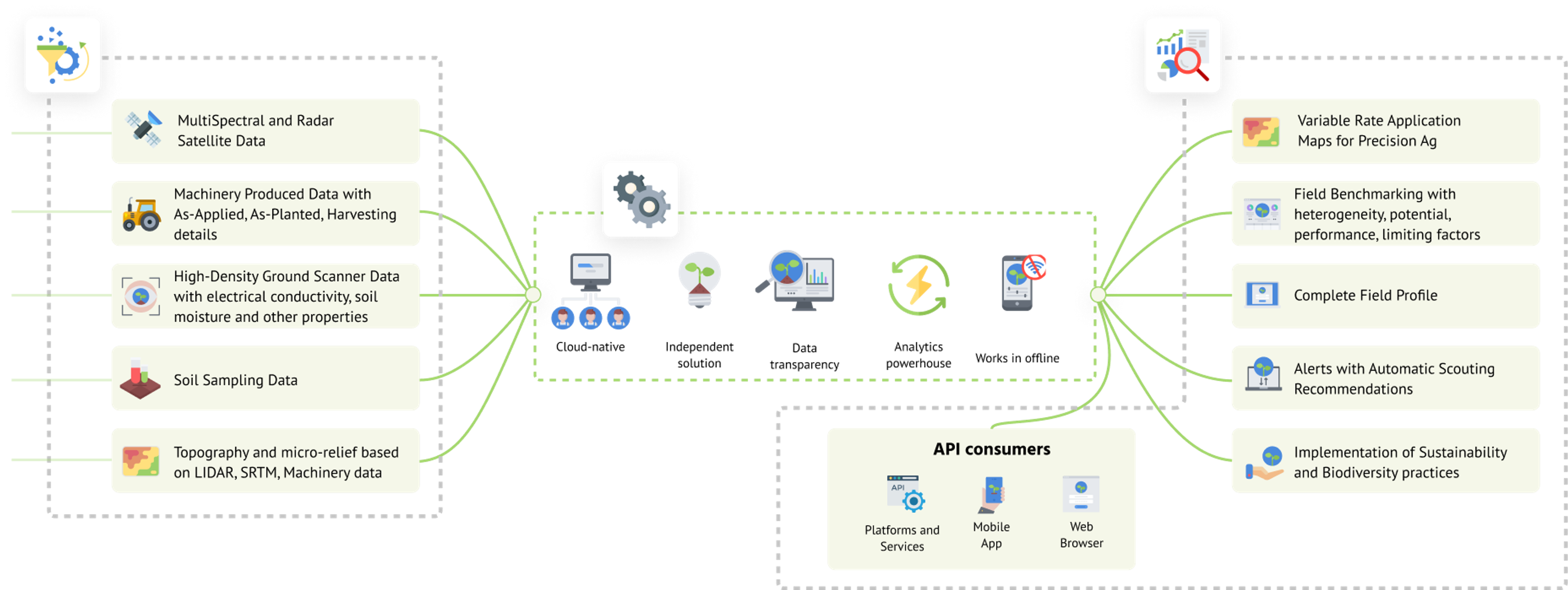
GeoPard is an agricultural intelligence platform that enables farms to increase their return on investment and integrate data-driven, sustainable precision agriculture practices using state-of-the-art spatial data analytics and AI algorithms. Specifically, GeoPard automates workflows to create variable rate seed, fertilizer, and pesticide application maps based on multiple data sources including satellite imagery, yields, soils, topography, machine data, and custom agronomic logic (including multi-layers and equations). GeoPard offers its solution as white-label, on-premise, API, web and mobile applications.
Pricing


Ab

255

per year (optional 155€ for half a year)


Free trial version

Attributes


This information has been reviewed and verified by the manufacturer. All data without guarantee.

Compatibility

John Deere Operations Center

Support

Mail support

Videotutorials

Software

Browser application

Android-App

iOS-App

Seeding functions

Sowing maps

Other subarea-specific functions

Own accounting of different data bases

Delineate management zones based on a combination of any data layers with the ability to set weights for each layer. Work with the complete set of parameters by performing integrated analyses:yield data, remote sensing data, topography, soil data

Equation based analysis

Create equations from scratch using your own formula or leverage the power of industry-standard equations.

Soil Sampling Design

Soil sampling at regular intervals across the landscape of a field. The grid size is selected to achieve the desired data resolution. The grid size is often set at 2-2.5 acres; however, if you want greater accuracy, grids of 1 acre can be used.

Economic zone evaluation

Know your ROI at farm, field, and zone levelEnter the actual market price of products. Set units for seed, liquid or solid fertilizerKnow the price of chemicals and seed for the specific farm operation

Datenintegration

As-Applied Daten

Yield data

Automated processing and cleanup.

Satellite images

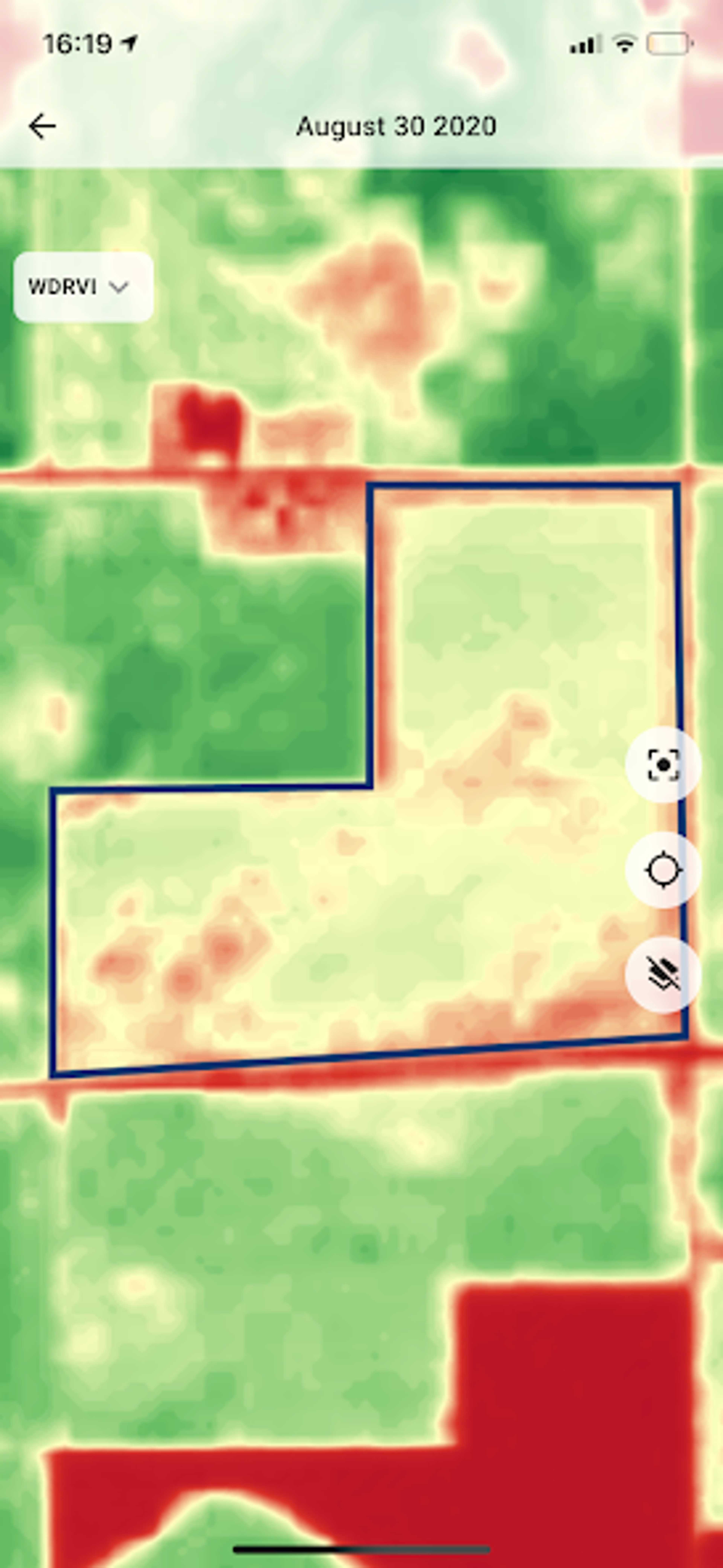
Data sources: Sentinel 2 (2015 - ...), Landsat (1988 - ...), Planet (2015 - ...), Radar data (2022), Hyperspectral imagery (2022)

Ground sensors

SoilOptix, TopSoilMapper/GeoProspectors

Soil analyses

Topographic data

Plant protection functions

Application maps for fungicides

Growth regulator maps

Application maps for herbicides

Application maps for insecticides

Field observation functions

Live biomass maps

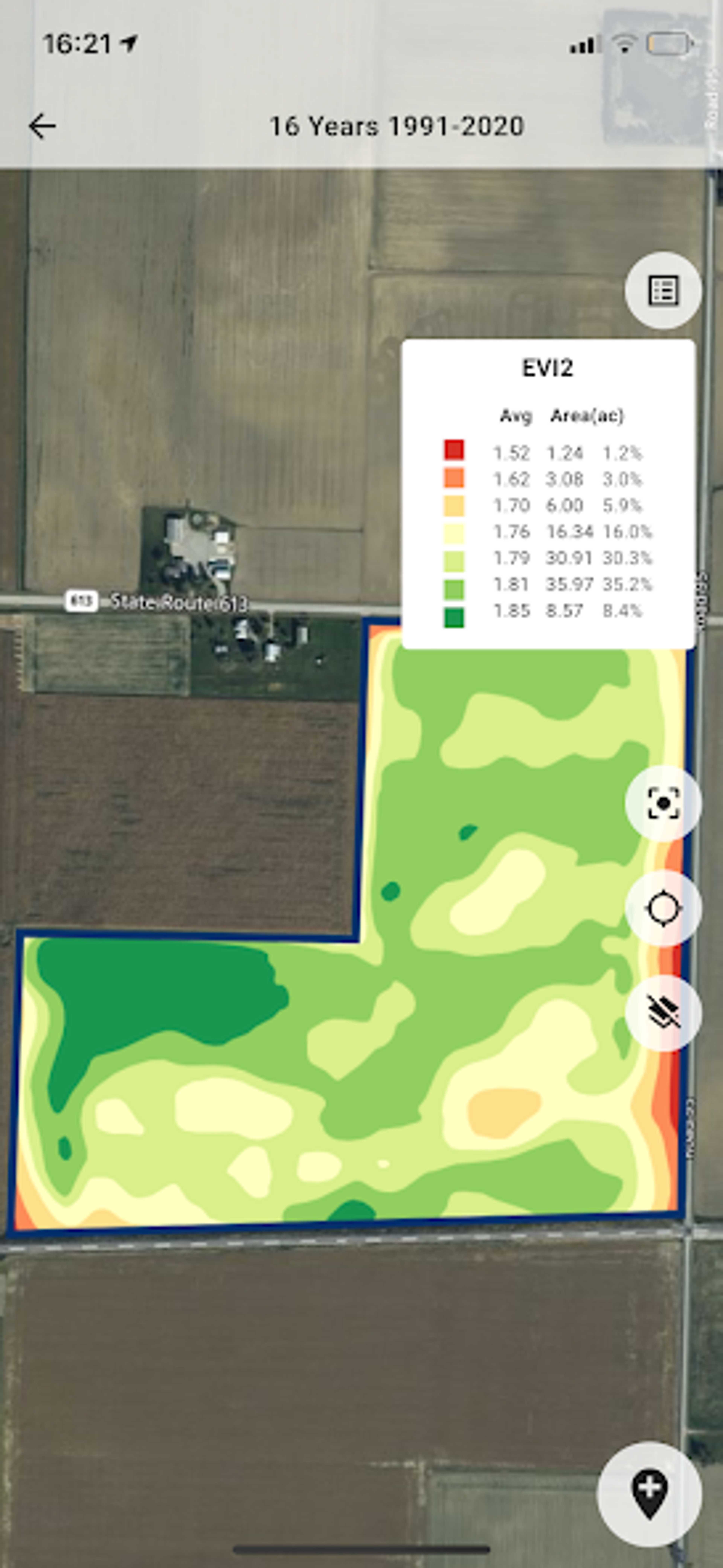
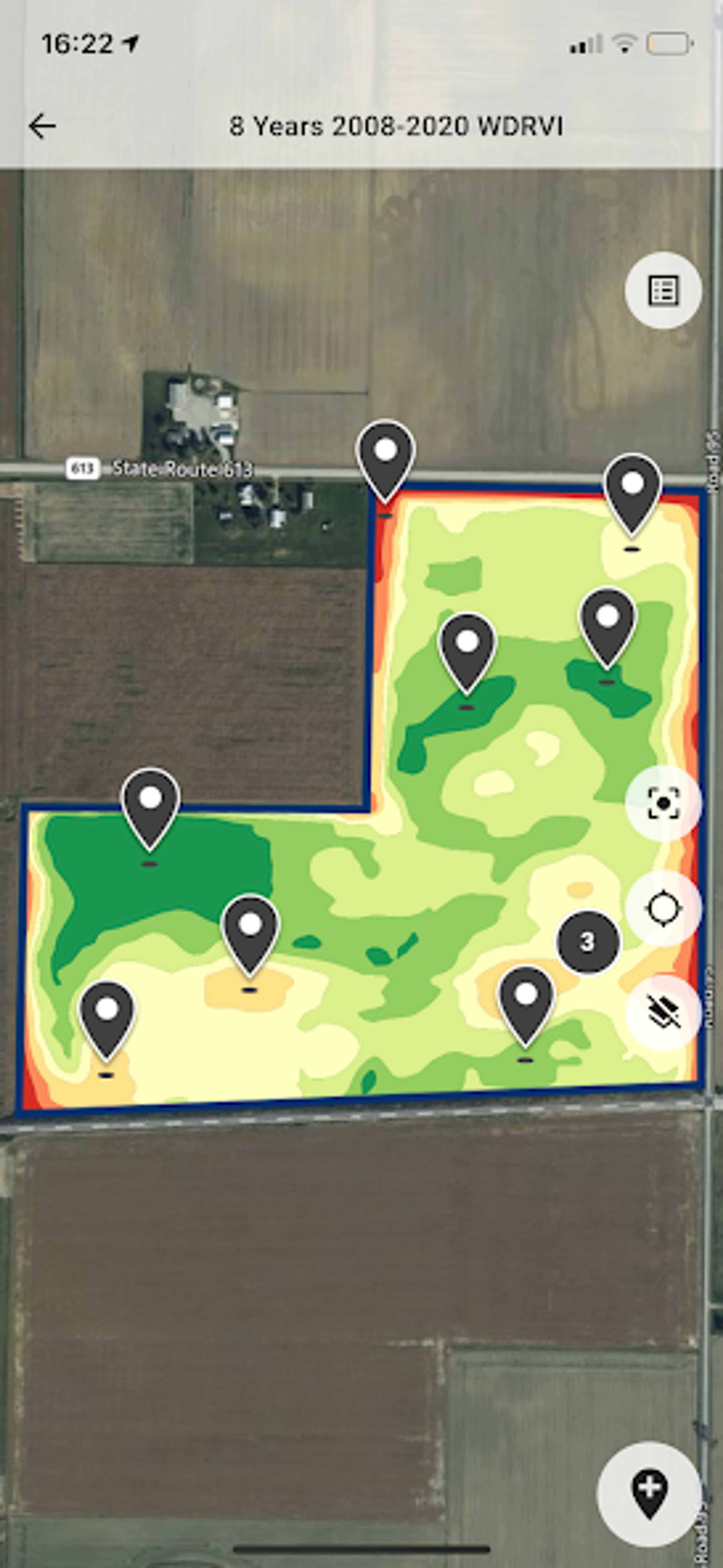
Compare imagery from different sources with the following indices: NDVI, ReCl, EVI2, LAI, WDRVI, GNDVI, GCI, RCI, NDWI, Soil Brightness Index

Field comparison

Stability maps to see the biggest changes in the field for each period or season.

Data layer comparison

Plane comparison feature enables visualization of field data and making informed decisions. Up to 4 data layers, Zoom, angle layers and mouse pointer synchronization, Visually identify limiting factors by comparing soil, topography, perennial vegetation and yield.

Georeferenced notes in the field

Sharing of information possible

Data sharing is possible via sharing links, access to a facility or the entire organization.

Fertilizer functions

Fertilizer cards - basic fertilization

Fertilization maps - N fertilization

Company


Flypard Analytics GmbH

Germany

Founding year:

2019

Similar products


Available soon!

We constantly add new features.

Enable notications

Categories


Available soon!

We constantly add new features.

Enable notications