Kleffmann Digital RS GmbH
MyDataPlant


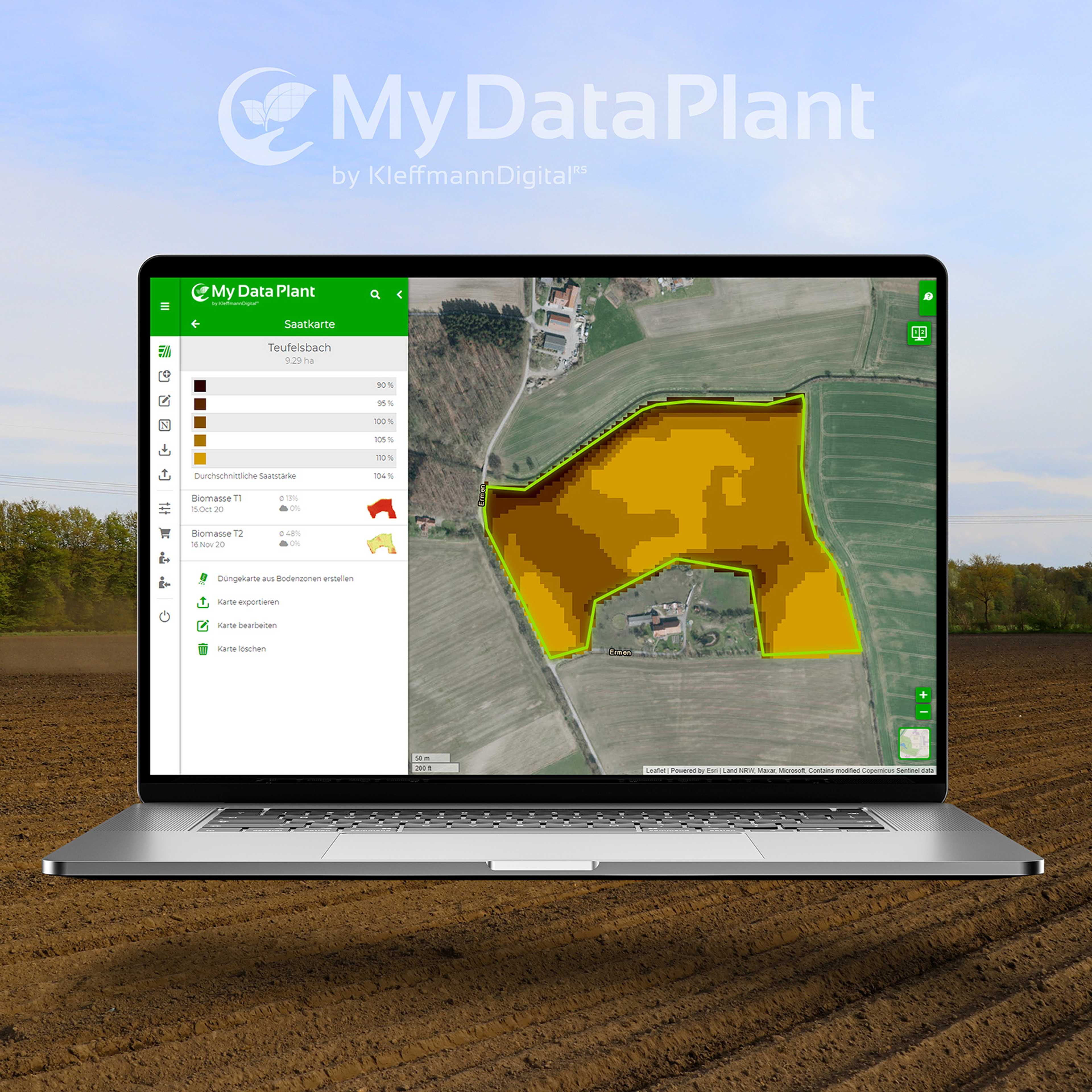
Sowing maps
As-Applied Daten
Yield data
Soil analyses
Application maps for fungicides
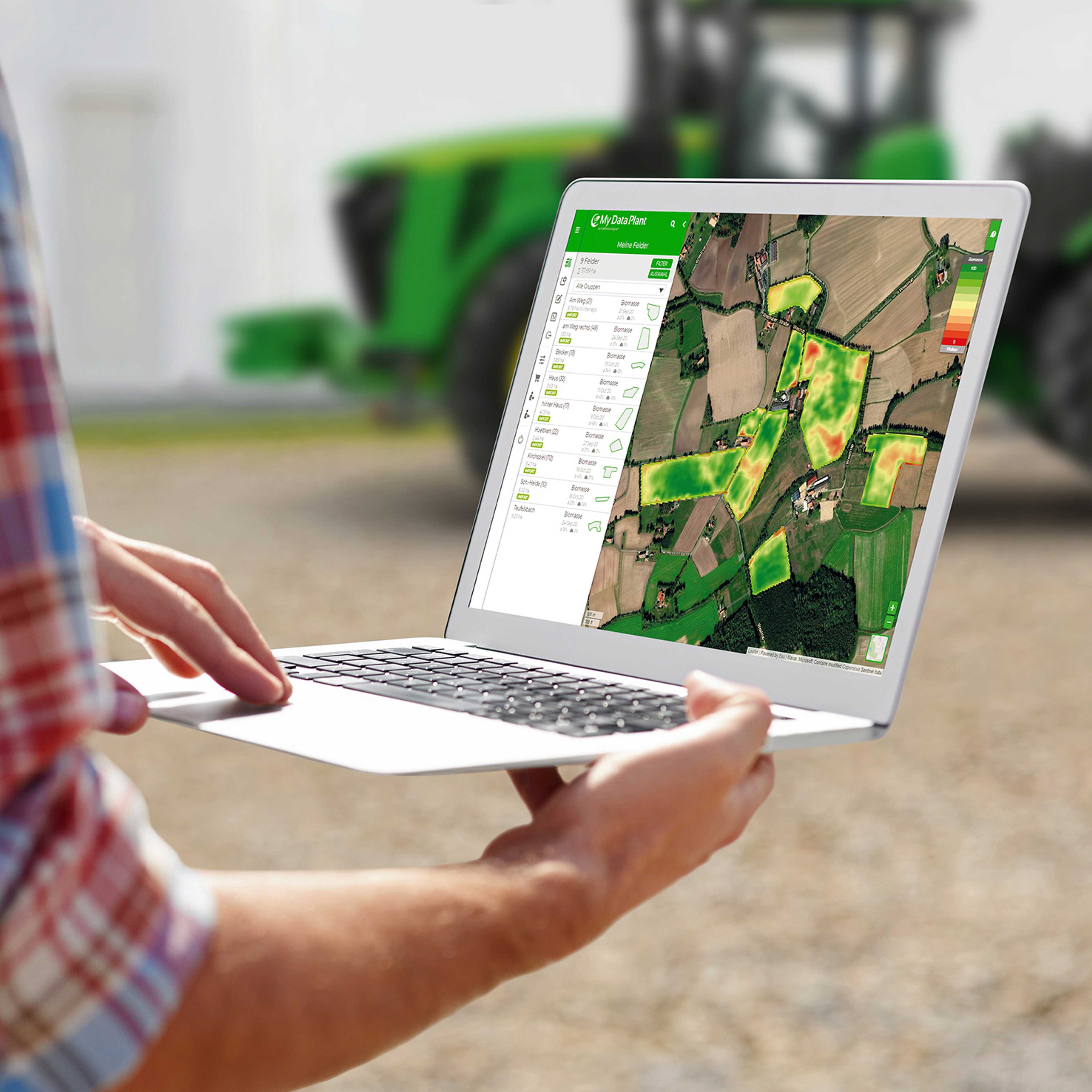
Live biomass maps


Precision farming platform with numerous functions for site-specific management based on satellite data and other sources.
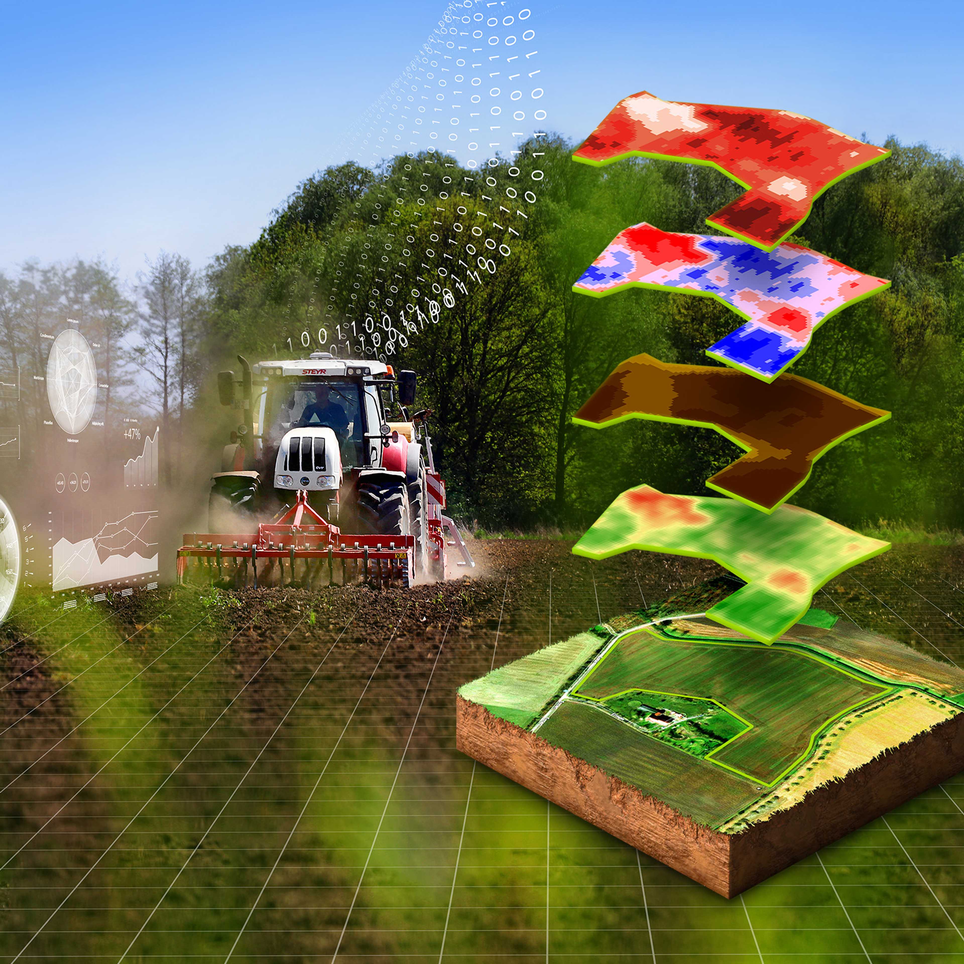
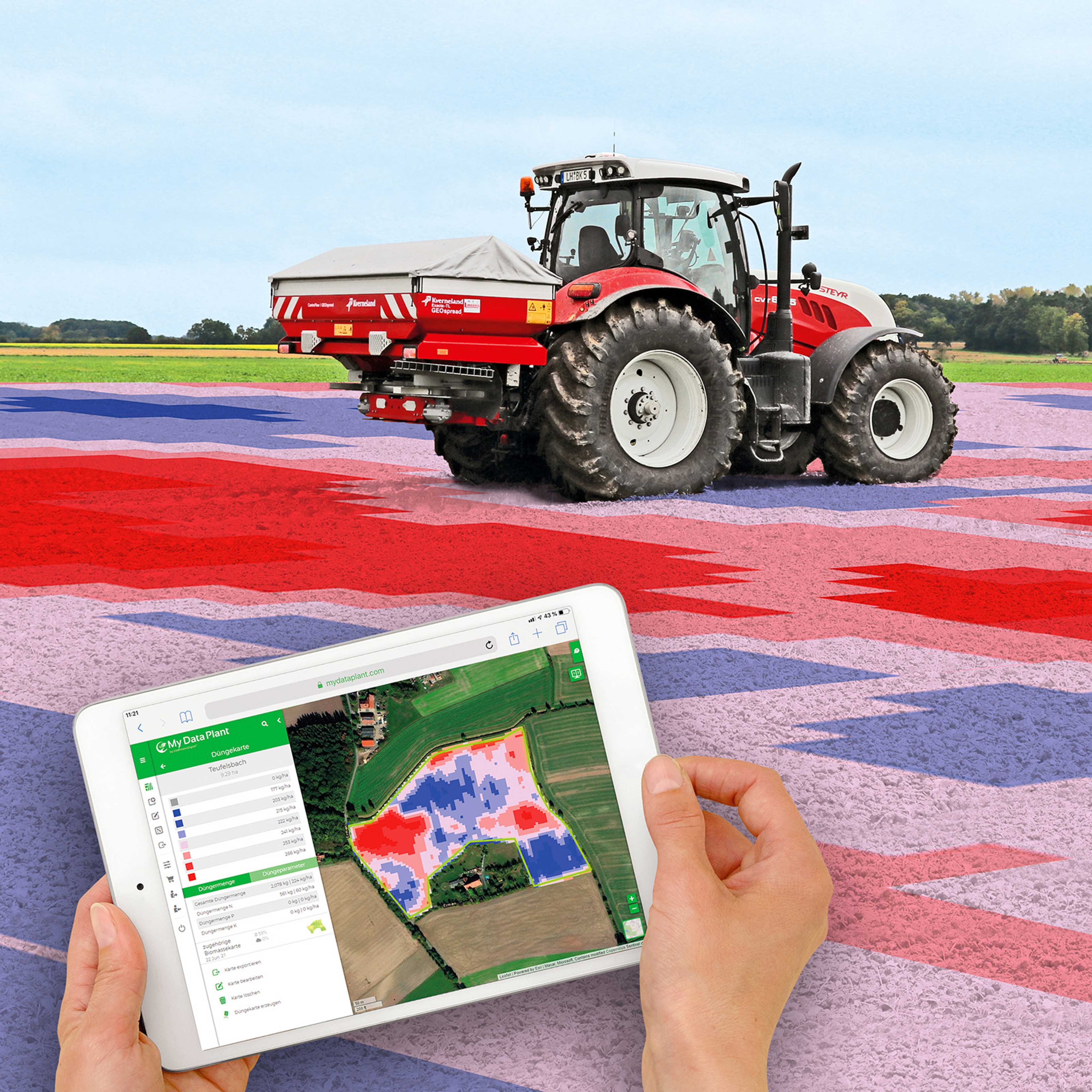
Application cards for seeding, fertilization and crop protection including biomass monitoring. Full compatibility with very good support and no hidden costs. 365 days subscription and MyDataPlant app for older machines. Pay once a year and create and download as many maps as you want.You can register via the MyDataPlant portal, draw or upload your fields to be farmed and create individual application maps for sowing, fertilization and crop protection with just a few clicks. By combining your farming experience with satellite data, you get application maps that are perfectly tailored to your fields. The Precision Farming Tool provides more precise field management and helps farmers make agronomic decisions. Costs can be reduced by up to 15% and yields increased by up to 7%. The created application maps can be easily transferred to any standard terminal via USB stick, the DKE-agrirouter or by means of telemetry modules. In this way, the fields and the stocks are managed in a demand-oriented and sustainable way. The resolution of 5 * 5 m guarantees highest accuracy. The portal works worldwide and is available in different languages.
Connect machines with fields to manage more precisely.
The MyDataPlant app offers the possibility to manage fields with machines that do not have the automated equipment precisely and according to the needs. It can be installed on the smartphone or tablet and shows in which zone the tractor is and what speed is required in this and the next zone.
In the app, hint points can be set on the field to mark water holes or frost damage, for example.
Furthermore, the app can be used for navigating towards the field, navigating in the field and taking soil samples. In addition, hint points can be set in the field to mark e.g. water holes, frost damage, disease incidence, etc.
Keep everything in view with modules on biomass, sowing, fertilization and crop protection.
With the biomass maps available every five days, you can permanently monitor your crops and future harvests from home using state-of-the-art satellite technology. The individual modules (biomass, sowing, fertilization and crop protection) can be compiled individually for each field and have a subscription period of 365 days. Within this period, any number of application maps can be created with the individual subscriptions. A 24-hour service hotline offers you additional permanent support for technical and agronomic questions. As a completely independent provider, Kleffmann Digital RS offers you with MyDataPlant a comprehensive and fully transparent platform for the individual and strategic management of agricultural land.
Zone maps can be created from data on biomass, yield maps, etc.
In addition to the modules for biomass, seeding, fertilization and crop protection, MyDataPlant also offers the Multilayer, which allows the creation of zone maps from various data sources such as biomass and imported data (yield maps, soil sampling, etc.). Also new in the program is a module for soil sampling planning. Here, sampling maps can be created for site-specific soil sampling. The zones can be drawn in either manually or fully automatically by a specially developed algorithm.

Pricing
Ab
6 €
for Hectar
6€/ha for first package (seeding, fertilization or crop protection), 2€/ha for each additional package, 2€/ha for Multiplayer Tool.
Free trial version
Modular expandable
Attributes
Compatibility
agrirouter
John Deere Operations Center
Other
Support
Phone support
Mail support
On-site support
Remote maintenance
Videotutorials
Software
Browser application
Android-App
iOS-App
Place of data storage
Seeding functions
Sowing maps
Other subarea-specific functions
Own accounting of different data bases
Consideration of distance requirements
Soil Sampling Design
Weather history
Current weather data
Weather forecast
Datenintegration
As-Applied Daten
Yield data
Satellite images
Ground sensors
Soil analyses
Type of data imports
Type of data exports
Plant protection functions
Application maps for fungicides
Growth regulator maps
Field observation functions
Live biomass maps
Field comparison
Data layer comparison
Georeferenced notes in the field
Sharing of information possible
Fertilizer functions
Fertilizer cards - basic fertilization
Fertilization maps - N fertilization
Company
Kleffmann Digital RS GmbH
Germany
Founding year:
2015