AGRAVIS Raiffeisen AG
Raiffeisen NetFarming

Recommendation fertilizer quantities
Fertilizer cards - basic fertilization
Recommendation fertilization time
Lane planning


Raiffeisen NetFarming of AGRAVIS Raiffeisen AG
High-resolution satellite images form the basis for many functions.
Raiffeisen NetFarming is a product area in the Ackerprofi portal for creating site-specific base and application maps for fertilization, sowing and crop protection as well as land cultivation.
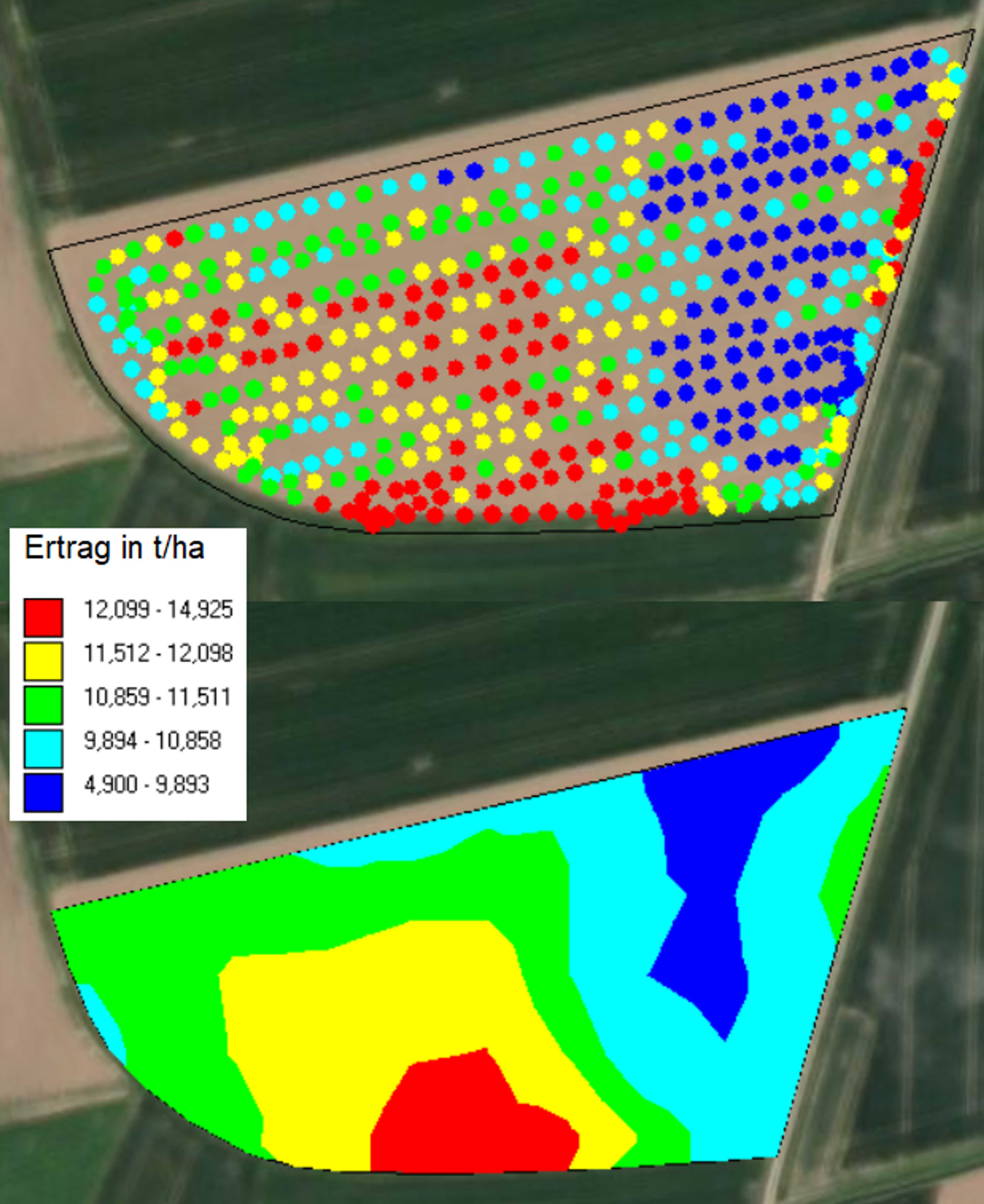
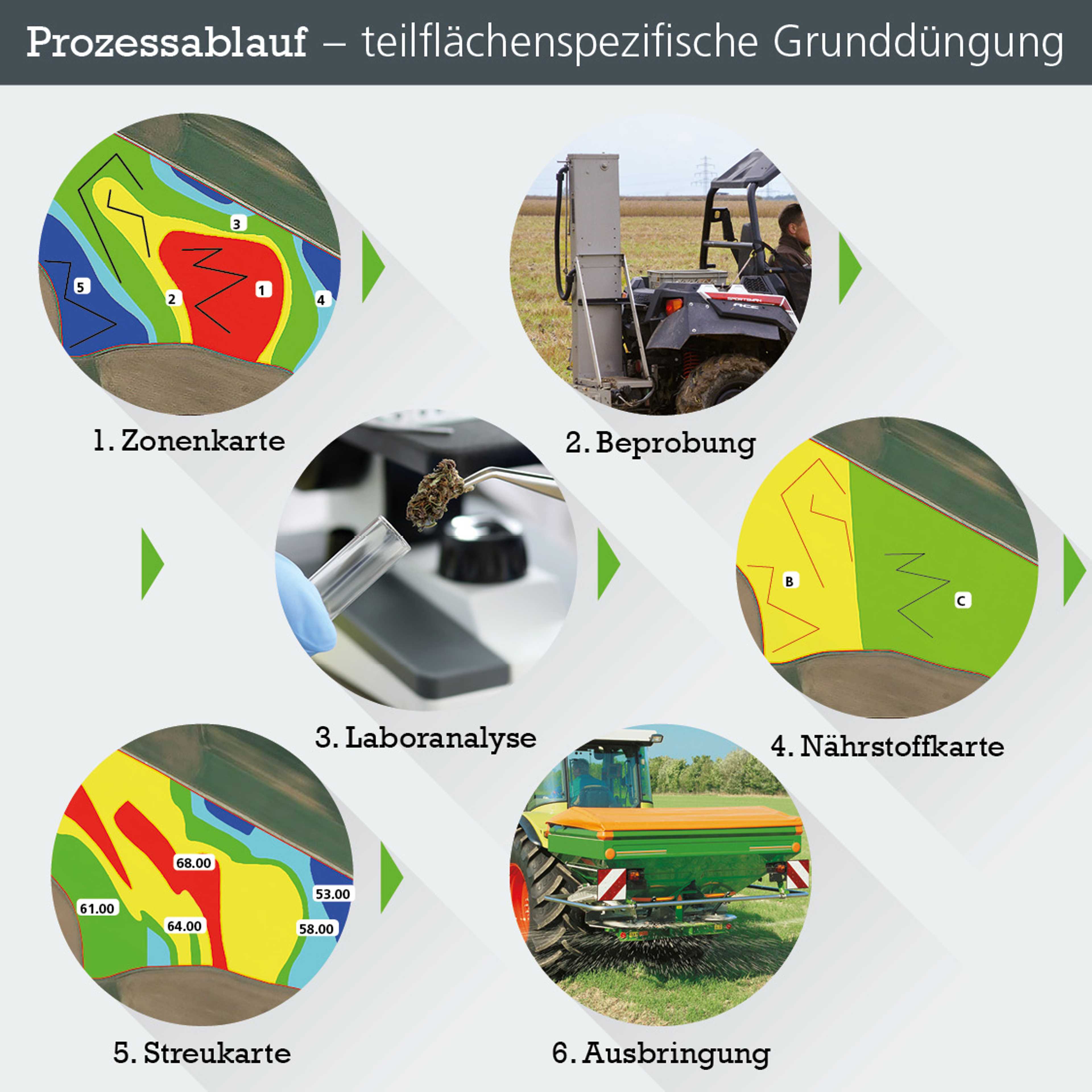
The basis for all applications is initially the management zone map based on high-resolution satellite images. It is divided into low and high yield zones. The basis for all applications is initially the management zone map based on high-resolution satellite images. It is divided into low and high-yield zones.
Sub-areas can be processed differently using digital area data.
A so-called management zone map is created using digital area data such as field boundaries, satellite images from recent years, yield maps or the farm manager's knowledge. By mapping the yield potential of the individual zones, differences in soil properties become visible and direct conclusions can be drawn about the extraction.
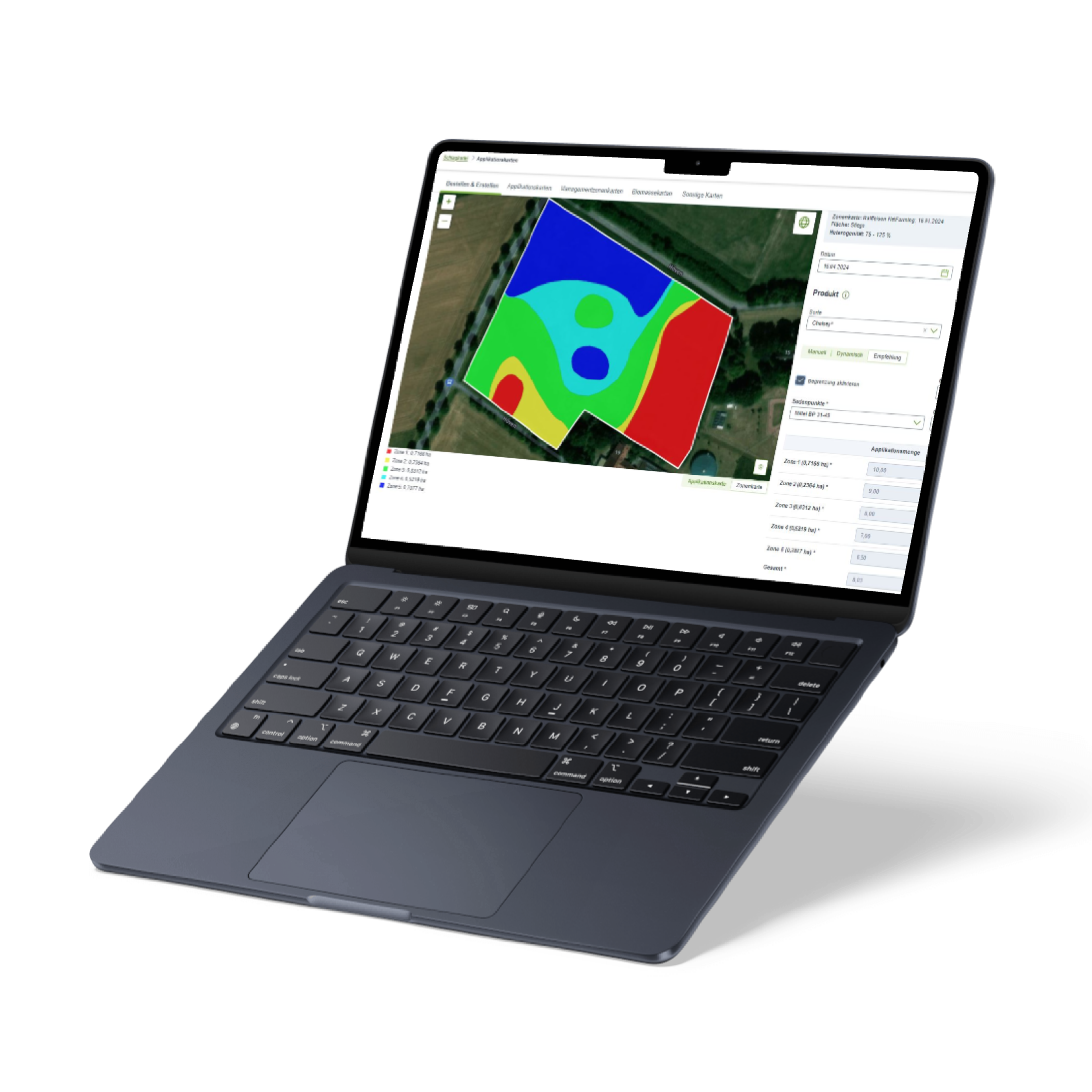
The zone map serves as the basis for soil sampling. The analysis results of the soil samples from the individual yield zones supplement the information, which is then used to create a nutrient map of the current supply status. The exact application rate is calculated using this nutrient map and the information from the management zone map.
The application card modules enable smart redistribution
In addition to basic fertilization, the application map modules make it possible to plan other fertilization measures based on zoning and heterogeneity and to generate a smart redistribution of the product. The module generally offers an extensive range of products and units that can be used for sowing and crop protection measures. The farmer can thus plan maps quickly and effectively and output them to the machine in the cross-manufacturer ISOXML and SHAPE formats. The data can be transferred directly to the fertilizer spreader terminal or optionally imported via USB stick.
Up to 10% more yield with the maize sowing module
The "maize sowing module" offers a special feature for maize fields. The farmer can use this tool to exploit the yield potential and achieve up to 10 % more yield by calculating an optimum sowing rate using a zone map, variety characteristics and details of the soil properties. This is based on an in-house algorithm developed by AGRAVIS Plant Production Consulting, which benefits from many years of variety trials and the AGRAVIS maize focus varieties.
Prerequisites: Digital field boundaries (from the area application, drawn in the portal or from farm management programs); cultivation history on the field over the last ten years; farm manager know-how --> Field-specific characteristics, farm-specific factors, modern fertilizer technology (or service provider).
Pricing
Upon request
Free version available
Modulary expendable
Different versions available
Attributes
Compatibility
agrirouter
John Deere Operations Center
ISOBUS
Other
Support
Phone support
Mail support
On-site support
Remote maintenance
Videotutorials
Software
Browser application
Android-App
iOS-App
Desktop application
Place of data storage
Seeding functions
Sowing maps
Recommendations sowing time
Recommendation sowing rates
Recommendation cultivar
Harvest functions
Maturity monitoring
Recommendation on harvest time
Other subarea-specific functions
Own accounting of different data bases
Equation based analysis
Consideration of distance requirements
Crop rotation planning
Soil Sampling Design
Lane planning
Economic zone evaluation
Weather history
Current weather data
Weather forecast
Watering functions
Irrigation maps
Recommendation watering time
Recommendation irrigation quantities
Datenintegration
As-Applied Daten
Yield data
Satellite images
Ground sensors
Soil analyses
Topographic data
Weather stations
Type of data imports
Type of data exports
Plant protection functions
Application maps for fungicides
Growth regulator maps
Application maps for herbicides
Application maps for insecticides
Field observation functions
Live biomass maps
Sharing of information possible
Fertilizer functions
Fertilizer cards - basic fertilization
Fertilization maps - N fertilization
Recommendation fertilization time
Recommendation fertilizer quantities
Recommendation fertilizer
Company
AGRAVIS Raiffeisen AG
Germany
Founding year:
2004